Today, you’re invited to follow this scavenger hunt, stopping at a series of plants that Garden staff have recorded a unique data point about. By the end, you’ll discover the many kinds of details mapped, measured, and remembered across the entire Garden by horticulturists, scientists, and our living collections team.
Living history
📍Stone Family Picnic Glade
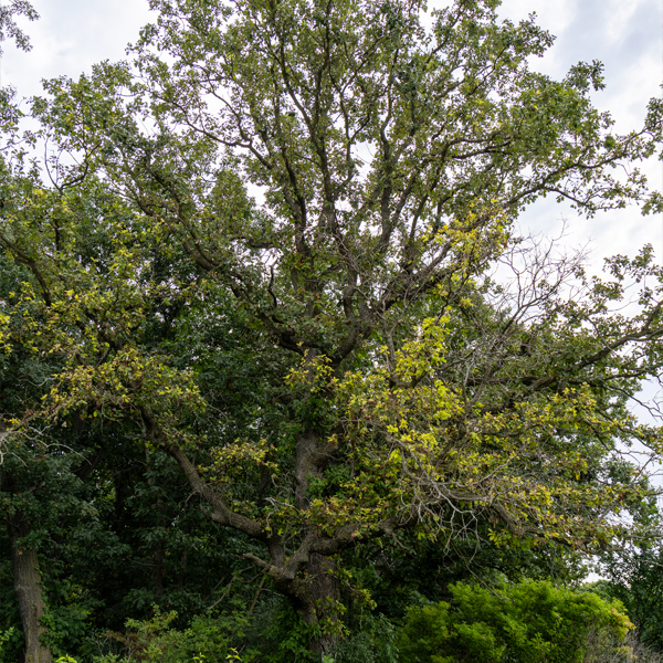
🌿Swamp white oak (Quercus bicolor)
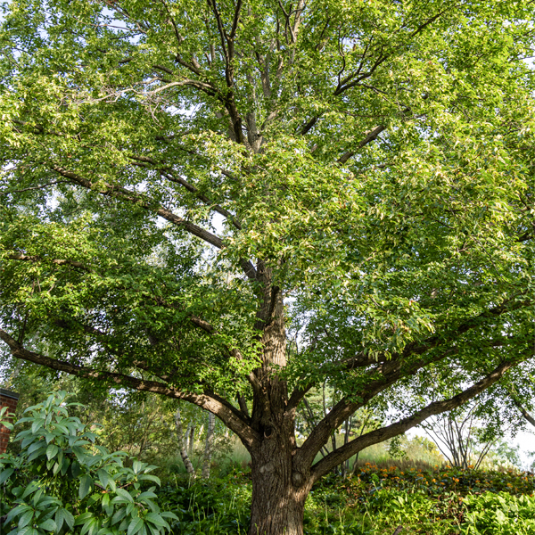
At 200 years old or more, this oak predates the Garden and represents important local history. In addition to protecting the living tree, we keep a pressing of its leaves in the Nancy Poole Rich Herbarium, a library where plants are pressed and preserved for scientific research.
On the clock
📍Greene Bridge at the Visitor Center
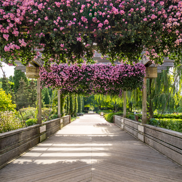
🌿Cascading mum (Chrysanthemum × morifolium ‘Pink Fleece’)
Look up: these Japanese 'Pink Fleece' cascading mums are trained to grow down instead of up. Starting each February, horticulturists attach more than 3,000 small hex nuts to the stems, training them into the sweeping display on the hayracks.
Another trick is timing their bloom. Mums bloom as days shorten, so the team manufactures darkness by dropping a black curtain in the greenhouse from 4 p.m. to 6 a.m. all summer, giving the plants exactly 14 hours of night. This careful measurement and laborious process turns into a bloom date you can count on.
Family ties
📍Heritage Garden
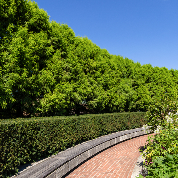
🌿Bald cypress (Taxodium distichum) and Hicks yew (Taxus x media ‘Hicksii’)
The Heritage Garden’s beds are organized by plant family, though family members don’t always look alike. The two hedges bordering the garden flip that script: they’re both conifers, similar enough to seem like cousins, but they’re actually from two different families altogether. Taxonomy often runs deeper than first impressions.
Well traveled
📍Farwell Landscape Garden
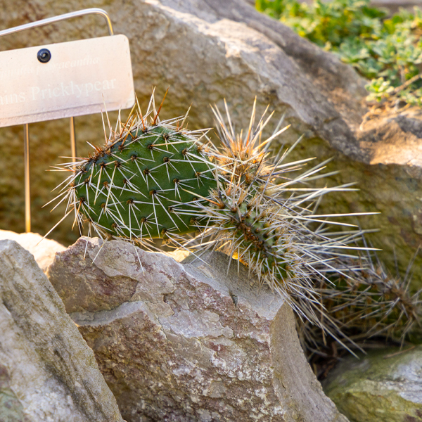
🌿Plains pricklypear (Opuntia polycantha)
To know whether a plant will thrive in this soil and this climate, we need to know where it came from. Provenance is an important part of every plant’s record. Since 1984, Garden scientists have been globetrotters for plants, collecting seeds from far-flung destinations to closer ones, like the Nebraska Sandhills where this pricklypear’s story begins. Every trip gets logged in detail: who collected it, where, and when. Back home, each seed has to earn its spot in the Garden, screened for invasiveness risk and vetted for whether it'll actually thrive here before it’s allowed to put down roots.
A tree that left a paper trail
📍Graham Bulb Garden
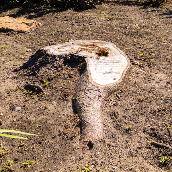
🌿Purplecone white fir (Abies concolor 'Violacea')
A tree used to stand here until lightning struck in June 2026 and it was removed for safety. But its story isn’t gone. Before our current system, Veronica created a paper map of the Garden, one that took five years to update. But a lot can change in five years. Our database keeps a record of plants even when they’re dead, and records why they died. Then, Veronica can update the digital map in real time.
Falling behind schedule
📍Sensory Garden
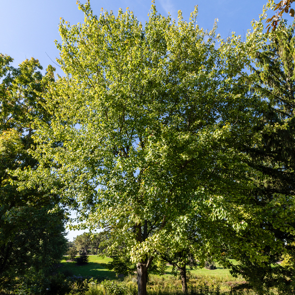
🌿Sugar maple (Acer saccharum)
Every fall, one question comes up again and again: when will the color peak? Garden scientists supported students from Lake Forest College as they tracked when sugar maples hit peak color, combining fresh observations at the Garden with 15 years of historical records.
They found that peak color is arriving later than it used to. Even small regional differences in temperature show up as measurable shifts in the calendar. One tree’s color change, tracked year after year, becomes evidence of a warming climate.
Trial to triumph
📍Sensory Garden
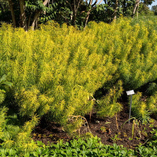
🌿Arkansas bluestar (Amsonia hubrichtii ‘Green Mist’)
Before this ninebark ever made it into a display garden, it had to prove itself. The Plant Evaluation Program—one of the largest and most diverse in the country—puts perennials, shrubs, vines, and trees through years of testing: How do they handle Midwest winters? Are they resistant to pests and disease? Do their flowers, foliage, and form hold up over time? Only the top performers graduate to a spot like this one.
Doctor’s orders
📍Evening Island
🌿Littleleaf linden (Tilia cordata)
This tree has been sick before, but it’s better now. Look up: this linden developed a split in its trunk (called an inclusion) that could have eventually caused the tree to crack in two. In 2015, staff installed a cable in the canopy along with a bolt through the trunk to hold things together. The bolt is hidden, but the split is still visible if you know where to look. Both are inspected every year. Every diagnosis and treatment gets logged, the same way a hospital keeps a patient’s chart.
Against the odds
📍Green Roof Gardens, Plant Science Center
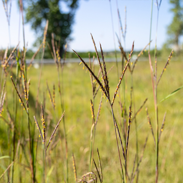
🌿Big bluestem (Andropogon gerardii)
Venture to the southern rooftop and look for the tallest plant up here. This native prairie grass is rooted in just 8 inches of gravelly soil, not the rich mix you’d expect a plant this tall to need. Up here, scientists track moisture, wind, light, and temperature in real time as 40,000 plants across 200 species and cultivars handle conditions few plants can survive. This is a living laboratory, the largest trial of its kind in the country. And big bluestem is a standout: proof that with the right data, even a rooftop can become a native plant haven.
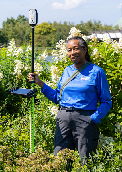
Veronica Harry-Jackson serves as the Geographic Information System (GIS) Specialist at the Chicago Botanic Garden. She is responsible for the creation and maintenance of over 2,306 bed plant maps representing 2.6 million plants.
A map with a brain
Most visitors who see someone wandering the Chicago Botanic Garden with a tablet and a tall pole assume she’s doing science. They’re not wrong, exactly. Veronica Harry-Jackson’s expertise is GIS: Geographic Information Systems, or as she puts it, “location with information.” It’s the technology that lets the Garden make a map of more than 1 million plants in the collection, spread across 385 acres and 711 planting beds.
Each plant has an accession number (like a social security number) and a record that tracks its story over time.
Just like the map on a smartphone, Veronica’s GPS (Global Positioning System) uses satellites to place a dot marking exactly where she stands. But unlike your phone, which can be offbase by the length of a school bus, Veronica’s GPS nails locations to within a foot. For a garden bed where every plant needs its own dot, that’s the precision she needs.
When Veronica started at the Garden in 2000, mapping a single plant took more than one set of hands. Veronica held a pole while a volunteer aimed an instrument that shot a laser to it, calculating the distance between them. From there, Veronica could compute the plant’s exact location, even on a slope and with the instrument set up across the lake. Plant by plant, she and her volunteers mapped hundreds of thousands this way, updating the Garden’s paper maps every five years.
Now, thanks to a single instrument that can do all calculations at once, Veronica and volunteers update digital maps of the whole garden four times a year. She works both outdoors and indoors, doing math the whole way. It’s her idea of the perfect job.